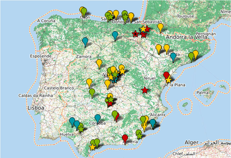
In yet another collaboration between Meipi and Basurama (remember Spermola), we are glad to have participated in our way in the 6000km project, which uses meipi to geolocate the panoramic photographs taken to document “the huge extensions of territory consumption of the large cities in Spain”, and “the uncontrolled growth of cities and the consumption of resources such as land or soil”.
The 6000km project is currently running a exhibition at Huarte contemporary art centre, Navarra: “Paisajes después de la batalla” / “Spain: Landscapes after the battle”. The exhibition, in their own words (Dossier in English) rises some questions:
“What are the effects of the exorbitant growth on the territory? What landscapes have been left for us by this cycle of prolonged economic expansion whose collapse we are witnessing these days? Do we have the ability to reverse some of the disasters committed or at least not to repeat mistakes made during these years? The project’s goal is to explore these landscapes after the battle.”
Quite a few panoramic photographs all over Spain have been gathered so far (see map above or explore in meipi.org) along with other documentation. One of the things we have done for the project is improve an automatic script that automatically walks through those locations, which is currently being used in the exhibition. Check that out embedded here (or also in meipi.org):
We look forward to seeing how the exhibition goes; we’ll also be back with more news on 6000km and the Lamboratory participation!

Post a Comment